
Taking action on climate change
Climate change is one of the greatest threats of our time, and we are already seeing the effects. Satellites are valuable tools we can use to increase our knowledge of climate processes and their impacts, and thus properly target our action plans and response activities.
Canada and 194 other countries reached a climate agreement at the Paris Climate Change Conference (COP21). During their discussions, they made use of data from Canadian satellites and space instruments.
Climate change is one of the greatest threats of our time, and we are already seeing the effects. Satellites are valuable tools we can use to better understand climate change and adapt to it. (Credits: Canadian Space Agency [CSA], NASA, European Space Agency [ESA])
Why use satellites to observe climate change?
In this section
Monitoring signs of climate change
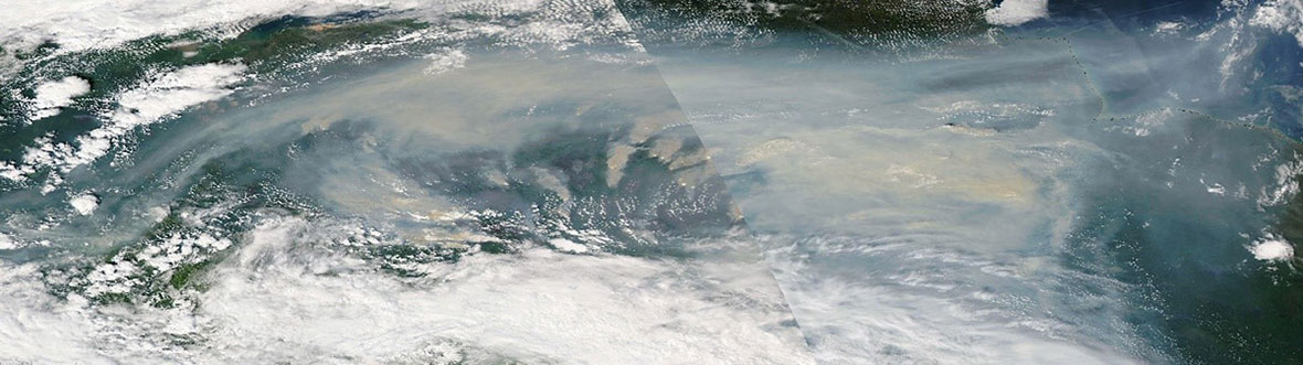
Climate change has various consequences, including the following: floods, hurricanes, droughts, wildfires, melting of polar ice caps, rising sea levels. The full scope of these catastrophic events can be seen from space. The impact of climate change is felt twice as quickly in the Arctic than in southern Canada.

Credit: CSA
Measuring pollution
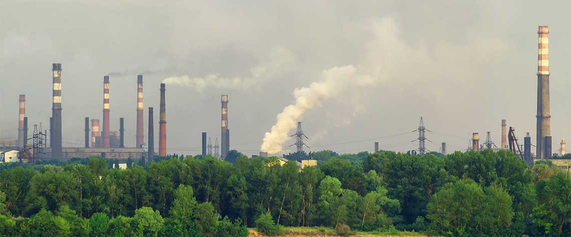
Human activities clearly have consequences for our planet. The energy we produce and consume, the manufactured products we buy and the way we dispose of our waste, at home and at work, are a major cause of pollution.
Space satellites help experts:
- identify pollution sources
- monitor and study air, water and soil quality
They can:
- gather data on carbon monoxide distribution
- detect oil spills
- locate areas contaminated by mining activities
SCISAT
What does it do?
SCISAT measures more than 70 different atmospheric gases.
What is it used for?
SCISAT is used to observe depletion of the ozone layer and to more effectively monitor developments in climate change, air quality and pollution. SCISAT data is used to develop international environmental policies to protect the ozone layer, such as the Montreal Protocol, which bans certain chlorofluorocarbons (CFCs).
Protecting our ecosystems
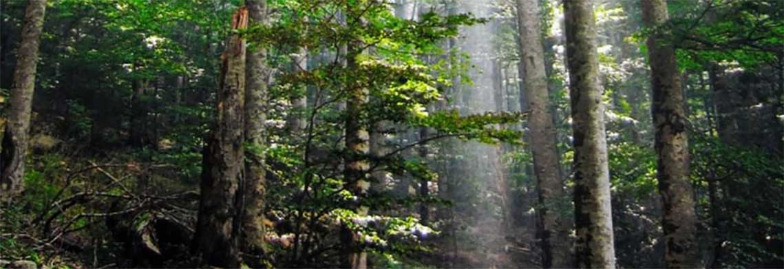
Did you know?
Forests cover almost one half of Canada's land mass.
The planet's ecosystems are essential to life and fulfill many of our basic needs. Satellites help us monitor changes affecting ecosystems and better protect them.
RADARSAT satellites
What do they do?
The RADARSAT Constellation Mission (RCM) offers data to many federal government departments to deliver important services to Canadians daily. These services range from the surveillance of illegal fishing and assisting disaster relief efforts in areas affected by wildfires to facilitating the delivery of vital supplies to isolated communities in the North.
RADARSAT-2 (owned and operated by MDA Space) provides data in various fields, such as marine surveillance, ice monitoring, disaster management, environmental monitoring, resource management and mapping in Canada and around the world.
What are they used for?
The RCM provides data used in maritime surveillance, disaster management and ecosystem monitoring.
RADARSAT-2 provides data that benefits users, such as farm operators, experts in cartography, hydrology, oceanography, forestry, and ice.
SMOS
What does it do?
SMOS can measure soil moisture and sea surface salinity on a global scale.
What is it used for?
These measurements help us: better understand the water cycle, map snow- and ice-covered areas, monitor the overall impact of climate change on ice.
SWOT
What does it do?
SWOT surveys 90% of Earth's surface water, measuring changes in water surface elevation for lakes, rivers, reservoirs, and oceans over time.
What is it used for?
Data from SWOT improves the delivery of services related to water, such as marine safety and security, water management, responsible resource development, fisheries, climate change adaptation, marine transportation and sustainable development in the North.
WildFireSat
What does it do?
WildFireSat is specifically designed to monitor active wildfires across Canada on a daily basis, while also supporting wildfire monitoring internationally.
What will it be used for?
WildFireSat data will support wildfire management. It will enable wildfire managers to determine which wildfires have the potential to burn out of control, which will help prioritize high-risk fires. In turn, this is expected to reduce economic losses, protect ecosystems, and secure critical infrastructure. In addition, it will contribute to air quality forecasting during wildfires.
High-altitude Aerosols, Water vapour and Clouds (HAWC)
What will it do?
HAWC is designed to improve our understanding of how clouds, water vapour, and tiny particles known as aerosols influence Earth's weather and climate.
What will it be used for?
Data collected by HAWC will will provide critical data to improve severe and extreme weather prediction, climate modelling, air quality forecasting, and the monitoring of events like volcanic eruptions, wildfires, and extreme precipitation.
Satellites are valuable tools to study the Earth on a global scale. The data they collect are crucial to help us better manage our natural resources, our environment as well as measure pollution and reduce the impact of climate change. (Credits: CSA, NASA, Parks Canada)
Taking action in the event of natural disasters
Because of climate change, natural disasters, such as droughts, floods, cyclones, typhoons and hurricanes, are becoming more frequent and severe. Quite often, they threaten the safety of entire cities.
In order to better coordinate their emergency response activities during a disaster, authorities around the world often turn to satellites. Emergency response teams, through the International Charter: Space and Major Disasters, use valuable data provided by the RADARSAT Constellation Mission to make informed decisions and effectively plan their response to disasters. The 17 member organizations, including Canada, a founding member of the Charter, are working together and promptly sharing their satellite data to assist people and protect infrastructure.