
RADARSAT-2 Tropical Forests: data access opportunity
A collaboration between the Canadian Space Agency (CSA), MDA Space and NRCan's Canada Centre for Mapping and Earth Observation.
On this page
1. Introduction
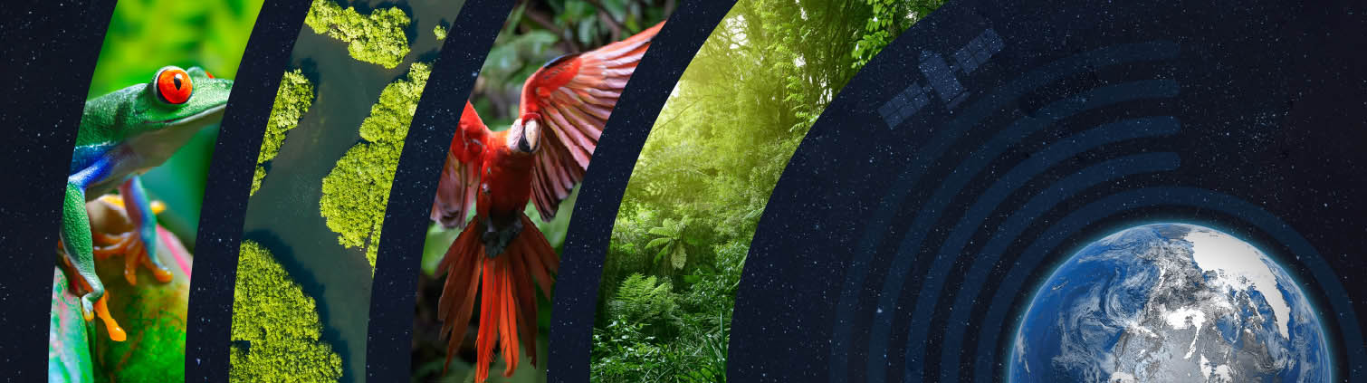
Tropical forests are crucial ecosystems that play a vital role in regulating the climate, acting as key carbon sinks and supporting the water cycle, thereby providing essential ecosystem services for populations at both local and global scales. They also provide rich habitats for diverse flora and fauna, making them biodiversity hotspots. However, despite their importance, tropical forests face significant threats from both natural and anthropogenic factors, which change their structure, composition and various other essential biodiversity variables. In this context, satellite Earth observation (SEO) technologies serve as a complementary tool for global tropical forest characterization and monitoring. By providing long-term data, SEO enables the tracking of ecosystem changes and threats, supporting degradation mitigation and conservation efforts.
RADARSAT-2 Tropical Forests (R2TF) aims to make a unique, long-term archive of RADARSAT-2 Synthetic Aperture Radar (SAR) data freely available to scientists and organizations around the world, without commercial intent. Its primary goal is to support the study of the impacts of human activity and climate change on tropical forests – ecosystems that are both critical and highly vulnerable. Covering circumtropical regions and spanning over a decade since , this high-resolution SAR data time series provides an unparalleled temporal record for monitoring forest cover changes. It also supports research in environmental science, conservation, and sustainable development.
R2TF is a unique collaboration between government and industry. MDA Space as the owner of the RADARSAT-2 system and RADARSAT-2 products has acquired a unique and relevant SAR dataset. Through the RADARSAT-2 program collaboration, the CSA has provided funding to process and make this data available to the research community. For R2TF, Natural Resources Canada (NRCan)'s Canada Centre for Mapping and Earth Observation (CCMEO) hosts the RADARSAT products on the Earth Observation Data Management System (EODMS) – a Government of Canada geospatial platform that enables users to discover and download Canadian and foreign satellite imagery.
2. Purpose and Objective
R2TF is an opportunity stemming from the CSA's smartEarth initiative, and supports the Canada's Strategy for Satellite Earth Observation by addressing several key objectives, including:
- Ensuring that SEO data is free and accessible to maximize science, innovation, and economic development;
- Harnessing SEO to address climate change and issues that matter to Canadians; and
- Inspiring SEO skills and capacity development for the next generation.
R2TF also aligns with Canada's commitments to the United Nations' Sustainable Development Goals (SDGs), the Global Biodiversity Framework (GBF) and the CSA's engagement in the Committee on Earth Observation Satellites (CEOS), particularly with regard to its commitments to biodiversity-related activities and to globally share RADARSAT-2 archive datasets over circumtropical forestsFootnote 1.
R2TF's primary goal is to enhance tropical forest research by distributing data globally with non-commercial objectives, ultimately contributing to more informed decision-making for conservation, land management, and climate impact assessments in these regions. More broadly, R2TF's objectives are to contribute to fostering collaborations among various user groups including scientists, governments, and conservation experts, strengthening common efforts in the climate change and biodiversity crises. By integrating advanced SAR technologies like the R2TF dataset into their research agendas, participating scientists are expected to help advance the common understanding of tropical forest attributes, dynamics and ecosystem trends. These could ultimately support future SEO-based applications such as real-time monitoring and early detection of ecosystem threats and provide a complementary tool for decision-making.
3. R2TF Dataset Characteristics
RADARSAT-2 is one of the world's most advanced Earth observation (EO) SAR satellite, offering users around the world an expanded range of high-quality data for multiple applications. This polar-orbiting satellite provides continuous all-weather C-band SAR imaging, day and night imagery for land and maritime monitoring with a 24-day revisit cycle and ascending/descending observation geometry. More information about RADARSAT-2 can be found in Annex A.
3.1 Technical Information
The R2TF dataset is provided in Single Look Complex (SLC) Level 1 format, meaning it is a formatted product where signal data has been converted to a readable computer structure containing target phase and amplitude information. The signal has undergone processing that includes range and azimuth compression and Doppler focusing while retaining phase information. Supported file formats include GeoTIFF, ensuring compatibility with major remote sensing and GIS software.
The table below provides technical information for the RADARSAT-2 Extra-Fine Wide beam modes (XF0W2 and XF0W3) available under the R2TF dataset which differ in spatial resolution, swath width, and incidence angles.
| Beam mode | XF0W2 | XF0W3 |
|---|---|---|
| Frequency Band | C-Band (5.405 GHz) | C-Band (5.405 GHz) |
| Wavelength | 5.55 cm | 5.55 cm |
| Polarization | Single (HH or VV) | Single (HH or VV) |
| Resolution (Near) | 6.0 m | 5.1 m |
| Resolution (Far) | 5.0 m | 4.5 m |
| Swath Width | ~124 km | ~120 km |
| Incidence Angle (Near) | 31,6° | 38,1° |
| Incidence Angle (Far) | 38,7° | 44,2° |
| Azimuth Resolution | 5.1 m | 5.1 m |
| Noise Equivalent Sigma Zero (NESZ) | -22 dB to -20 dB | -22 dB to -20 dB |
| Orbit Altitude | 798 km | 798 km |
| Radiometric Resolution | 1 dB | 1 dB |
| Data Products | SLC (Single Look Complex) | SLC (Single Look Complex) |
| Revisit Time | 24 days | 24 days |
| Beam Mode | Extra-Fine | Extra-Fine |
| Observation Geometry | Ascending & Descending | Ascending & Descending |
3.2 Geographical Distribution
R2TF datasets cover part of the world's tropical forest regions over four (4) sub-continental areas: Central America, South America, Africa, and South-East Asia as shown in Figure 1 below.
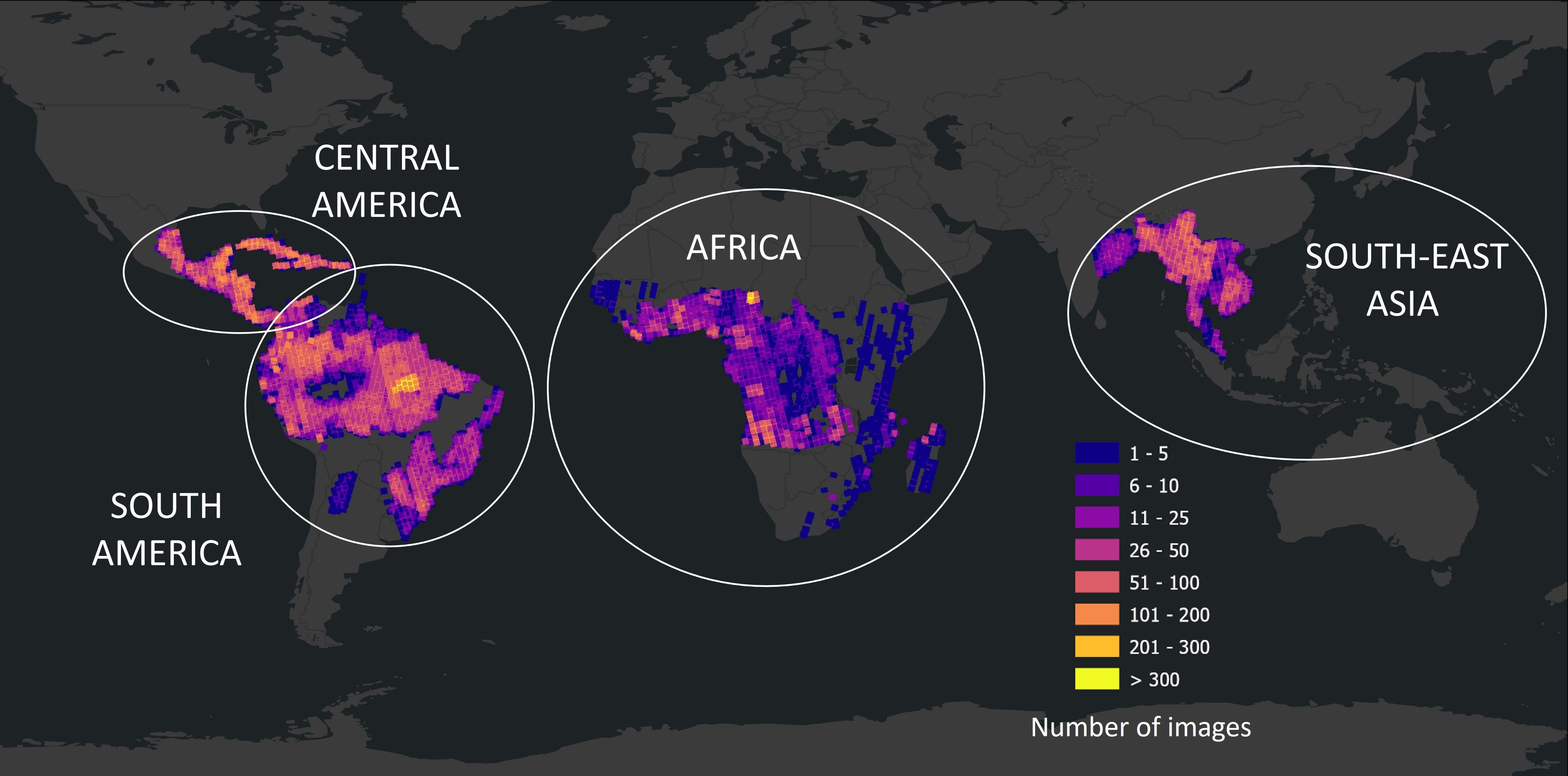
Figure 1 : This density map represents the location of each sub-continental R2TF dataset, and the number of images processed to date among a larger number acquired from to above all circumtropical forests. (Credit: MDA Space)
4. R2TF Dataset Access
Access to the R2TF dataset is provided through the NRCan-CCMEO Earth Observation Data Management System (EODMS) platform. The current section describes how the data can be accessed, starting with the applicant's organizational eligibility.
4.1 Eligibility
Eligible Recipients
The applicant must:
- Hold a permanent, term, student status, or a contract position from a recognized university or post-secondary institution, or from a recognized organization;
- Complete and submit, on their organization's behalf, an application form and successfully be granted access;
- Identify as the primary individual who will access the requested dataset on behalf of the organization; and
- Belong to an organization that is eligible to receive RADARSAT-2 products according to the RADARSAT-2 data policy and the regulatory conditions for RADARSAT-2 product access.
Eligible Projects
To be eligible, projects must consist of one or many of the following:
- Research activities linked to the R2TF purpose and objective (see section 2);
- Activities to foster the continuing development of a critical mass of researchers and highly qualified people; and
- Activities to support the creation of new knowledge, scientific studies, and research.
4.2 Application Process
All potential users of the R2TF are invited to quickly discover the dataset using the following KML map file.
The R2TF data access opportunity will only accept applications through the process defined in this section. Applications submitted by other means, such as email, will not be considered. Figure 2 shows a simplified view of the application steps.
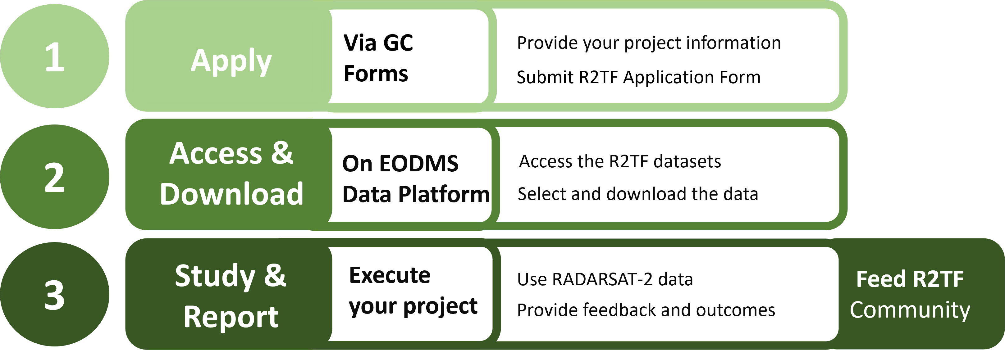
Figure 2 : Application process steps to be followed by each applicant under the R2TF opportunity.
The applicant must already own or create an account on the EODMS platform. The EODMS account will provide the applicant an access to the dataset in discovery mode. This mode allows applicants to search and identify available data for their proposed project area of interest and dates, thereby informing their research agenda ahead of the formal application process.
- The applicant should note that a Github page is available to support the applicant's EODMS registration.
Applicants, with their EODMS account username and pre-identified dataset of interest, can then submit their application through the GC Form platform.
The form is completed on behalf of the applicant's organization and comprises five (5) sections:
- Privacy Statement and Declaration;
- Applicant's Organization Information, including the EODMS account username/email;
- Project Information, including objectives and requested dataset;
- Project's Expected Outcomes; and
- Confirmation Page.
An applicant shall submit different applications for each project.
Once submitted, the application is reviewed by CSA-R2TF officers. Successful applicants will receive an acceptance email with further instructions to access the data on the EODMS platform. Others will receive an ineligibility email.
4.3 Data Access Process
R2TF dataset downloading is made through the EODMS platform. Successful applicants can access the data as a single stack or on a country-by-country approach. Users are encouraged to consult the EODMS training documentation on the Github webpage to learn how to retrieve and access their dataset.
5. Terms and Conditions
R2TF applicants must comply with the following Terms and Conditions specified in RADARSAT-2 End User License Agreement (EULA). The EULA is available in three languages:
- Government user RADARSAT-2 end user license agreement.
- Accord de licence d'utilisation de RADARSAT-2, licence du gouvernement (French only, PDF, 131 KB)
- Usuario gubernamental, contrato de licencia de RADARSAT-2 para el usuario final (Spanish only, PDF, 126 KB).
This document establishes the terms and conditions regarding data ownership, grant of license, warranty, limitation on liability, satellite regulations & export control laws, termination, governing law, miscellaneous, authorized licensee, permitted uses, prohibited uses, definitions, copyright, and language.
Additionally, successful applicants are asked to keep the R2TF Officers informed on their research project's progress and outcomes, related to indicators such as those listed in the Application Form in the Project Information and Project's Expected Outcomes sections.
6. Support and Resources
6.1 Contact Information
For more information on the R2TF data access opportunity, please contact the R2TF Officers at r2tf-r2ft@asc-csa.gc.ca.
6.2 User Documentation and Tutorials
The following tutorial was created to assist users with the usage of RADARSAT data. It is geared towards beginners and offers a step-by-step guide to direct users with plotting the raster files and shapefiles of RADARSAT missions in python and QGIS.
The following page covers questions and tutorials about the EODMS platform:
Annex A – RADARSAT-2 Technical Information
The multiple mode capabilities of RADARSAT-2 respond to the evolving needs of clients and encourage the development of specialized applications. With three times the resolution of RADARSAT-1, RADARSAT-2 offers more precision for identifying objects such as ships at sea, and its 512 separately controlled mini antennas can be quickly reconfigured. In addition to the HH polarization offered by its predecessors, RADARSAT-2 can also image using HV, VH, or VV polarization.
The graphic gives a visual representation of the coverage area of each RADARSAT-2 imaging mode along the satellite ground track (nadir), as well as the satellite velocity vector. The beam modes are shown in the following order from left to right: Spotlight; Ultra-Fine; Wide Ultra-Fine; Extra-Fine; Multi-Look Fine; Wide Multi-Look Fine; Fine; Wide Fine; Fine Quad-Pol; Wide Fine Quad-Pol; Standard Quad-Pol; Wide Standard Quad-Pol; Standard; Extended Low; Wide; Extended High; Ship Detection; ScanSAR Narrow; Ocean Surveillance; ScanSAR Wide.
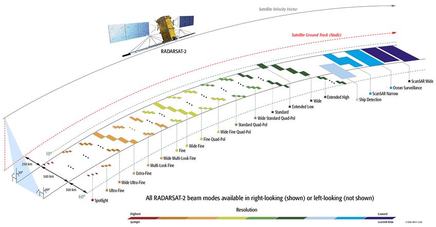
Figure 3 : RADARSAT-2 beam modes technical information. (Credit: MDA Space)
Annex B – International Alignment
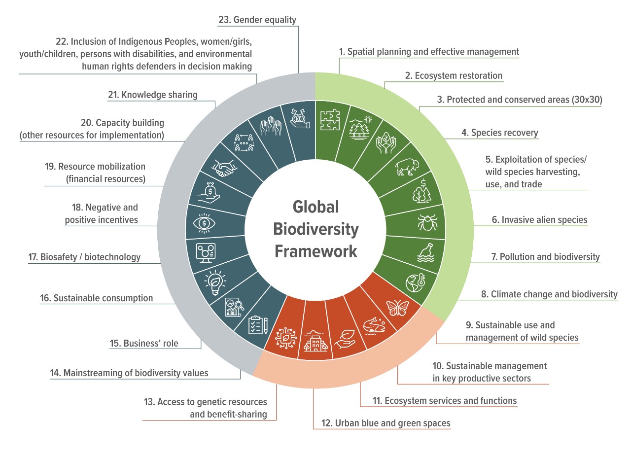
Figure 4 : Kunming-Montreal Global Biodiversity Framework (GBF) targets. (Credit: Environment and Climate Change Canada)
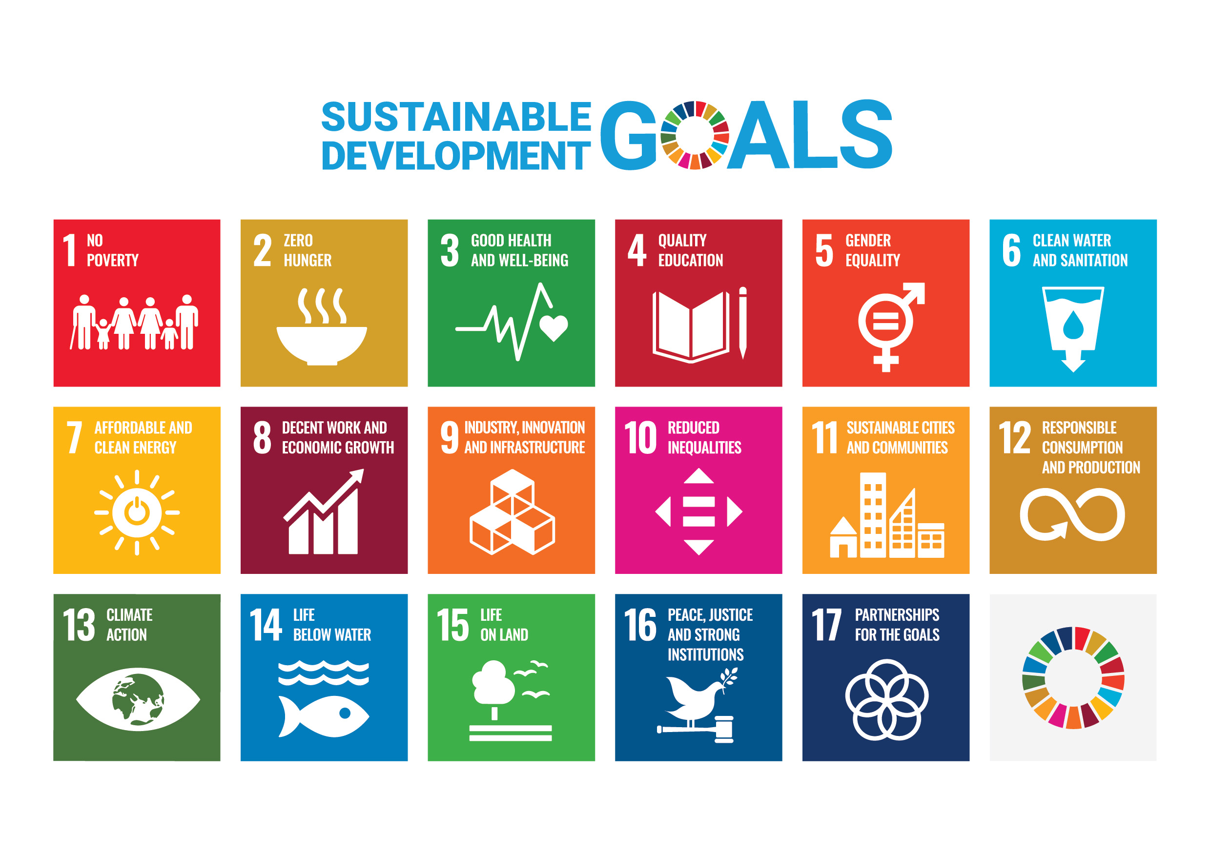
Figure 5 : The United Nations' 17 Sustainable Development Goals. (Credit: United Nations))
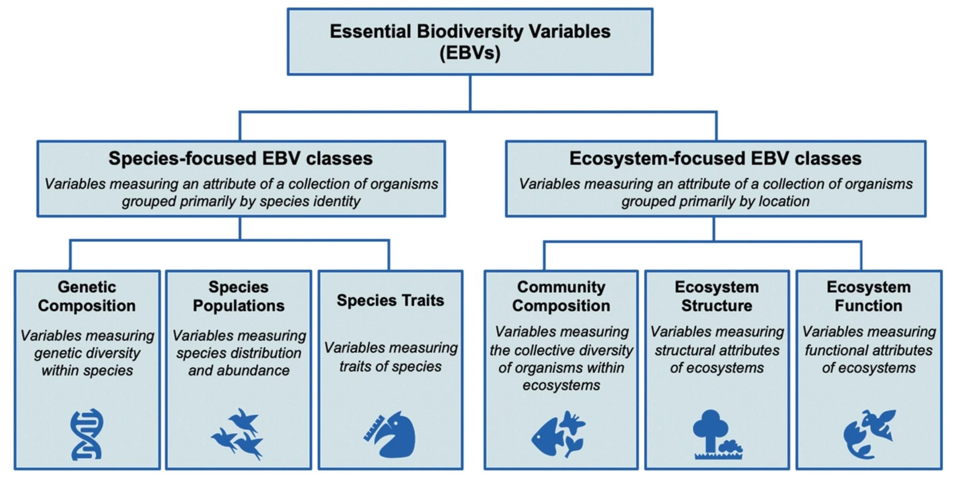
Figure 6 : Essential Biodiversity Variables. (Credit: Springer, Cham)