
Space Apps Challenge

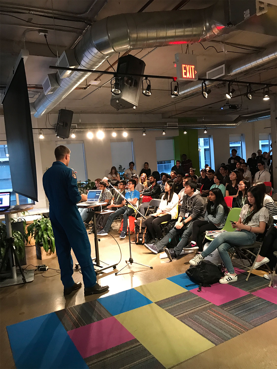
The NASA International Space Apps Challenge is the world's largest annual global hackathon. It aims to encourage participants to solve real-world challenges using open data from space. This hybrid event usually takes place during the first weekend of October.
Since , the Canadian Space Agency (CSA) has partnered with NASA to provide Canadian data, training resources, and the support of experts and judges for the Space Apps Challenge. This partnership has continued ever since, engaging participants from across the country, with local events being held from St. John's to Vancouver to Inuvik and many places in between.
Every year, participants can choose to tackle a NASA or a CSA challenge. Those who complete a Canadian challenge will get a chance to win one of the prizes offered by the CSA. This event is open to all, regardless of background, allowing participants to engage in technical or non-technical challenges.
How can you get involved?
If you are interested in participating in the Space Apps Challenge, click on this year's event to find more information.
Not sure if this event is for you? Read the summaries of the past Canadian challenges below to have a better idea of what it means to take part in the hackathon.
Challenge
Challenges
This year, the CSA is holding two challenges.
Challenge 1. Too Long, Didn't Read: What's Up in Space?
The purpose of data is to help people make decisions. We all know that having too little data makes this difficult, but how about too much? When you have large amounts of data, it can become difficult to separate what is important from the noise, particularly when one has limited time for analysis.
The goal of this challenge is to take large amounts of data and present it in a way that allows decision-makers to get the information they need at a glance. To tackle this, we need you to make use of the data to create compelling and interactive visualizations, designed with specific users in mind.
Details
You use data to make decisions every day – whether that be by checking the weather before getting dressed, checking reviews before deciding to binge-watch the latest shows, or comparing prices for the same item at different stores. Does the summarized data you are looking at have all the details you need? Have you ever not read a text because it was too long? Perhaps you need a summary.
People who use satellite data have the same issues. In this challenge, you will create a summary for a data user, for example, a satellite operator or a natural disaster responder. What type of data do you think they would need, and how should it be presented? How can you make sure that they are getting the information they need, with limited noise?
Two examples are provided to help understand the challenge, but you can identify other end-users and user-cases.
Example 1: Satellite Operator wanting to maintain their space situational awareness
A satellite operator needs to understand not only their own satellite systems, but also the space environment in which their satellites operate. This is known as maintaining their space situational awareness. Space situational awareness is about having good, actionable knowledge of what's happening in space, both for the satellites being operated and the environment around them. It includes risks due to space weather and due to close approaches (also known as conjunctions) with debris, rockets or other satellites, etc. With things changing so rapidly in space (new launches, new threats, new data sources, etc.) and so many datasets and other sources of information, it isn't easy to present and understand the most important information quickly and accurately, because who has time to read all those detailed technical reports?
Here are some examples of what a satellite operator may be interested in.
- How many satellites are there at different altitude ranges (and in particular, at the altitude range where I will operate my satellites)?
- What is the current/upcoming space weather forecast (and in particular, how will the space weather forecast affect my satellites)?
- What satellites are de-orbiting (and in particular, will they fall in my area)?
- What are the near-Earth asteroids we should be worried about (and in particular, how worried should we be)?
- What close approaches (or conjunctions) should we be worried about (and in particular, for the satellites I manage)?
Example 2: Emergency responder using Earth Observation data to help make decisions
An emergency responder is responsible for planning and coordinating the flood response for a Canadian municipality. They are constantly looking for the latest data to show them the current flood situation and help them understand how it could continue to evolve.
Here are some examples of what an emergency responder may be interested in.
- What areas are currently flooded? How does this overlap with infrastructure, such as building and roads?
- What's the best route to take that brings first responders as close as possible to the worst flooded areas?
- What's the weather right now, and how will it change over the next few days? Will it make the situation better (sunny days) or worse (torrential rain)?
- How can I communicate this information effectively to people on the ground?
Remember that these are just examples. You can implement a solution for either of these or choose your own use case for another user. Just make sure that you keep a specific end-user in mind.
Stargazer (regular):
Design an innovative new way to summarize and present the current and evolving state of your chosen dataset to your end-user in a way that informs and educates quickly, while meeting their unique needs. For this Stargazer challenge, you don't need to code a solution, but rather think about how to present the data to a non-technical audience and potentially in a non-technical format (a poster, a graphic, an animation, a song, sketches/mockup of a user-interface without implementation, etc.).
Moonwalker (advanced):
Design and implement an innovative new way to present the current and evolving state of the space environment (or other in a way that can serve your selected end-user in their operational needs). Implementation could be a website or a mobile application that is continually refreshed by new data from suitable public sources.
Potential Considerations
When designing these interactive visualizations, consider:
- Are your visualizations accessible? Consider colour choices, labels, and format.
- What is the story of your visualization? Does it show the vision you are trying to accomplish?
- Which information is key to be added in the visualization?
- How can you minimize the bias in your data visualization project and provide a comprehensive overview?
Did you know that many Canadian satellites generate open data that can help inform and contribute to your solution?
- RADARSAT Constellation Mission (RCM) is Canada's flagship Earth Observation mission, generating data for many terrestrial applications including disaster response and management.
- NEOSSat looks at near-Earth objects, including asteroids and space debris.
- CASSIOPE looks at space weather, including the effects of solar storms.
- SCISAT looks at the chemical composition of the atmosphere.
The links to the datasets are found in the "resources" section.
Moonwalkers: Processing large amounts of image data is likely going to be difficult over 48 hours. We recommend that you identify suitable subsets of data to develop and demonstrate your solution.
Resources
Astronomical data archives:
- NEOSSat astronomy data
- Canadian Astronomy Data Centre: includes NEOSSat and James Webb Space Telescope archives, updated daily.
- Asteroids & Comets:
Space weather data archives:
- CASSIOPE Satellite Data on Earth's Space Environment
- Solar radio flux data: pertains to the radio emissions of the sun as felt on Earth.
- More about space weather:
Satellites, Space Assets and Space Debris data:
- Space object catalogues, including information about conjunctions:
- Space-track.org (free account required)
- Celestrak
- New Launches: Spaceflight Now
- Orbital Re-Entries: aerospace.org/reentries
Earth Observation data archives:
- SCISAT atmospheric chemistry data
- RADARSAT Constellation Mission and RADARSAT-1 (Earth Observation) data:
- Earth Observation Data Management System (EODMS) – Natural Resources Canada
- Copernicus Earth Observation Data Archive
Key Words
space situational awareness, resident space objects, space debris, space weather, near-earth objects, Earth observation
Challenge 2. Curiosity Collective
Citizen science is the practice of public participation and collaboration in scientific research to increase scientific knowledge. Citizen science projects promote scientific literacy and public engagement by empowering the community to find answers to issues they care about. In these projects, volunteers from diverse backgrounds engage in data collection, analysis, and interpretation.
Your mission, should you choose to accept it, is to design or promote a citizen science project using Canadian open data. With this challenge, you will have to encourage citizen scientists to explore the wonders of space by using data to shape the future of science, while creating a lasting impact with passion and creativity.
The Canadian Space Agency is involved in many space missions and has collected a significant amount of data over the years. This data comes from international collaborations and nationally led projects, with varied mission themes including astronomy, life in space, Earth observation, ozone gases, magnetosphere, space situational awareness, and many more.
Step 1 (for everyone)
Use Canadian/CSA data to develop a citizen science project.
- Give a definition of what a citizen/open science project is.
- Develop a plan and idea using Canadian and/or CSA data.
- Choose a dataset of interest.
- Educate yourself on the mission and data. You can start by looking at the links provided in the resources section.
- Identify and formulate the project objective.
You can choose any of the datasets outlined in the consideration or the resource section. Additional examples are provided there as well.
Step 2
Choose either the regular or advanced path.
Stargazer (regular)
Promote the project by either making a poster, writing a song, a book, or a short story, making sure to highlight Canadian space and/or CSA data and/or the project objective.
Moonwalker (advanced)
- Select and sort a data subset within the chosen archive which has the potential to address the project objective (this depends on the chosen dataset, as some may already have been downsized).
- Identify the tools and methods necessary to analyze the data and achieve the project objective. Some tools have already been provided in the resources section below, although you may use others.
- Create a step-by-step procedure (including tutorials) for citizen scientists to collect and analyze the project data.
- Design an interactive website for the citizen scientists to participate in the project or explain how you would upload your project to an existing platform.
Be creative and have fun! If possible, try to do something that has never been done before.
Potential Considerations
When designing your project, consider:
- The target audience of the project you are promoting or the website you are creating to ensure accessibility and clarity.
- The Indigenous data stewardship initiatives and ethical aspects to consider in attempting the citizen science challenge.
- The types of data you would like to use for the challenge. You can find the data for each under the resource section:
- Space Exploration:
- NEOSSat (astronomical targets such as comets and/or stars with potential exoplanets): data from the world's first space telescope dedicated to detecting and tracking asteroids and satellites. Unlike ground-based telescopes, NEOSSat is able to track satellites and space debris in a wide variety of locations and not be limited by geographic location, the day-night cycle, or weather.
- James Webb Space Telescope (galaxies and/or exoplanets): the James Webb Space Telescope is the most complex and powerful space telescope ever built. Canada has contributed a scientific instrument and a guidance sensor. Canadian scientists are taking part in its exciting science mission that promises to change our understanding of the universe. Webb is an international collaboration between NASA, the European Space Agency, and the Canadian Space Agency.
- Earth Observation:
- CASSIOPE (space weather, including aurora): the CASSIOPE satellite observes Earth's ionosphere and collects data on the effects of solar storms and, more specifically, their harmful impact on radio communications, satellite navigation and other space and ground-based technologies.
- SCISAT (identify a specific gas in the atmosphere): this satellite measures more atmospheric gases than any other in the world. Its dataset contains multiple air pollutants (NO, NO2, SO2, CO, CH4, and CFCs) for you to use, including unique atmospheric profile data for each gas (concentration as a function of altitude).
- RADARSAT-1 and the RADARSAT Constellation Mission (major cities, lakes, forest fires): these satellites use a technology called synthetic aperture radar (SAR), which can be used to assess biodiversity, map forests and even global changes in vegetation.
- Space Exploration:
Resources
Types of Datasets to use:
CSA Open Data and Information Portal
CSA Open Code: includes data tutorials (bilingual)
Space Exploration:
- NEOSSat: CSA Open Data and Information Portal and Canadian Astronomy Data Centre
- James Webb Space Telescope: Canadian Astronomy Data Centre
- OSIRIS-REx:
- OSIRIS-REx data: CSA Open Data and Information Portal
- OSIRIS-REx main documentation: Data Product Software Interface Specifications
Earth Observation:
- CASSIOPE Satellite Data on Earth’s Space Environment
- SCISAT – Atmospheric Chemistry Experiment
- RADARSAT-1 and RADARSAT Constellation Mission (RCM) data and tools:
- RADARSAT-1 and RCM (you will need to create an account) open data on Natural Resources Canada’s Earth Observation Data Management System
- RCM wildfires open data: CSA Open Data and Information Portal
Tools, packages and tutorials to utilize the data
Tools and packages:
- Astropy package
- Google Earth
- Geo Tools
- Open Source Geographic Information System QGIS
- Geospatial Data Abstraction Library – Python
Tutorials:
- Usage and visualization of RADARSAT data (bilingual)
- Visualization of RCM wildfires data – Python and QGIS (bilingual)
Examples of citizen science platforms:
Key words
open science, citizen science, astronomy, Earth observation, asteroids, geomatics, atmospheric gases, magnetosphere
Challenge
Challenges
1. Exploring the distant universe with James Webb Space Telescope
Challenge description: Launched on , James Webb Space Telescope (JWST) is now fully operational and producing some of the deepest images of the Universe. Several datasets are publicly available, from the commissioning phase and early release observations that are already pushing the limits of infrared astronomy. This challenge has to do with the search and detection of distant galaxies in images obtained with JWST.
2. Space Survival Adventure
Challenge description: Space may seem empty and peaceful, but it's a dangerous environment for humans and space systems like satellites and the International Space Station! Space-based threats include cosmic radiation from the sun, signal interferences, meteoroids from near-Earth comets and asteroids, and space debris. Operators must measure and understand these threats as part of their space situational awareness, allowing them to minimize their impacts on our daily lives – from disabled satellites, power system failures, disturbed communications and GPS, rerouted or cancelled flights, and early satellite re-entry. Can you use Canadian data to find new ways to educate and raise awareness around these space-based challenges?
3. Global Methane Pledge
Challenge description: Methane is a powerful but short-lived climate pollutant that accounts for about half of the net rise in global average temperature since the pre-industrial era. Governments from around the world, including Canada, have signed on to the Global Methane Pledge at the latest UN Climate Change Conference (CoP26) in , aiming to curb global methane emissions by catalyzing global action and strengthening existing international methane emission reduction initiatives. Can you help raise awareness about methane emissions via an interactive game or create an integrated picture of global methane emissions using Canadian data?
4. Asteroid Delivery Service
Challenge description: Launched in , OSIRIS-REx travelled to near-Earth asteroid Bennu, and is on its way home to deliver a sample (arrival Sept. 24, 2023). Since scientists believe that Bennu has remained mostly unchanged since formation of our solar system 4.6 billion years ago, this sample will help scientists shed light on how our solar system formed, and might help explain how water came to Earth. Can you help OSIRIS-REx navigate the surface of Bennu, and explore how the mission will inform scientific discoveries for decades to come?
Challenge
Challenges
1. Historic space storm hunter
Challenge description: Can you find perturbations of the ionosphere in historic Alouette I data? Global change is leading to more extreme weather events. Can you detect if space weather events have also become more extreme (over the course of Alouette I data collection or even up until now)?
2. Art and science: prototype of an Earth observation satellite
Challenge description: The CSA's satellite development team needs your fantastic ideas to prototype the next generation of satellites. The team wants the satellite of the "future" to be as nimble as a squirrel, as quick as a rabbit, and to unfold like the wings of an eagle. Will you help them and start working like a busy beaver?
And, just like the tortoise, the new satellite will need to adapt to changes over time without changing its "home". Ask your family to help you! Have each person takes on a role just like a pack of wolves would do (e.g. someone can be the leader).
Once you have built your satellite, take a photo of it and show us how it travels (its trajectory). You can animate your satellite by creating a GIF animation.
3. Space Radiation Danger
Challenge description: This challenge consists in establishing a risk scale of space-weather caused satellite resets, which is the risk of satellite computers shutting down because of strong radiation in space. To this end, data on single-event upsets taken directly from the Canadian satellite CASSIOPE needs to be meshed with multiple open space weather datasets to determine what factors cause the upsets, and devise a way to estimate the risk that the satellite would be affected by space radiation a day in advance, enabling better satellite operations
4. From coast to coast to coast: a tool for assessing climate change vulnerability (challenge from the Scientific Advisor to the President)
Challenge description: Your challenge is to develop a situational awareness viewer to assess climate change vulnerability areas in northern regions. To meet this challenge, you will need to draw upon a wealth of data, including satellite imagery from RADARSAT-1.
Viewer requirements:
- Be able to ingest various types of data including RADARSAT-1 imagery
- Be able to geolocalize satellite imagery
- Be able to overlay data layers on top of RADARSAT-1 (point, line, polygon)
This challenge is a collaboration between the Canadian Space Agency, Natural Resources Canada and the Alaska Satellite Facility.
5. Pollution spills high above us
Challenge description: Can you spot major atmospheric pollution events (e.g. major explosions, fires or chemical spills) in atmospheric gas measurements from SCISAT?
6. Explore space with Canada's space telescope, NEOSSat
Challenge description: Launched in , Canada's microsatellite-based space telescope NEOSSat tracks Near-Earth asteroids, comets, stars with potential exoplanet transits, and other astronomical targets, alongside surveillance of resident space objects in Earth's orbit (such as satellites and space debris), producing thousands of images per week. This challenge involves designing a solution to characterize and classify space objects of interest within the public image datasets, and potentially visualize the time-series evolution of these objects through engaging animations or other graphical tools.
7. Leveraging AI/ML to monitor, detect and quantify ozone recovery in the stratosphere
Challenge description: The UN Montreal Protocol has been responsible for the recovery of the stratospheric ozone layer. The global recovery of this gas is of international concern and important for human health. Recently, an increasing amount of trace gases in our atmosphere including greenhouse gases, have been blamed to mask the rate of this recovery. For this challenge, we would like to leverage Canadian and international space-based datasets to explain this slow recovery.
Testimonials
"Dedicate your whole weekend to the Space Apps. After all, it could be the start of a career in space exploration!"
"My team and I loved participating in the Space Apps Challenge. We were able to get our hands on really cool data and use it to work on a really interesting project, all while meeting other space enthusiasts and being mentored by subject matter experts. We would highly recommend others to participate in it this upcoming year!"